Photorealism – Exhibition Preparations
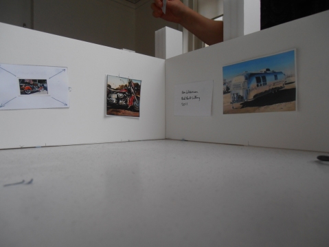
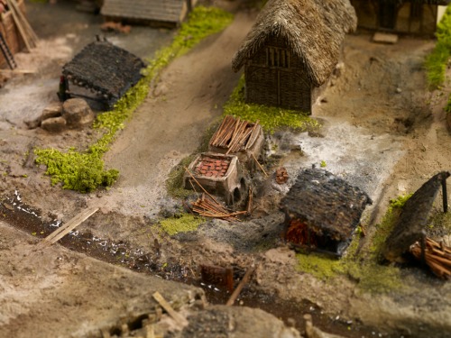
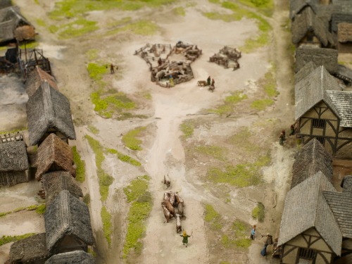
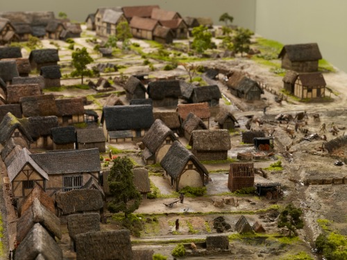
It’s just over a month until Photorealism: 50 Years of Hyperrealistic Painting opens in the Gas Hall and we’re busy preparing how it’s all going to look using our model. It’s a lot smaller than the real Gas Hall but still big enough that we have to keep it in two halves! Here’s a sneak preview of how it might all look and some of the fantastic paintings that’ll be in the show…
Photorealism opens Saturday 30th November 2013 and is on until 30th March 2014. For more information about the exhibition please visit: http://www.bmag.org.uk/events?id=2740
Katie Hall,
Exhibitions Officer
Exploring Birmingham’s Medieval Streets
A recent talk I gave for the University of Birmingham’s People, Places and Things series of seminars prompted me to write this latest instalment about medieval Birmingham. In fact, it was a question from a member of the audience after I presented the video of Exploring Medieval Birmingham, 1300 that determined the topic of this blog. The person in question asked if I’d thought about superimposing images or footage of Birmingham’s present-day streets over the medieval depictions illustrated in the video. Nice idea, and yes, I did think of doing exactly that, but budgetary and time constraints prevented me from doing so, but that isn’t to say that this can’t be achieved in the near future. Nevertheless, until then this blog will attempt to fill a ‘void’ in going half way to doing just that.

Depiction of medieval Birmingham at the end of the 13th century with St Martin’s Church sitting at the centre of the town.
The 1296 Borough Rental referred to in my previous blogs on medieval Birmingham mentions around ten streets in the 13th-century town. Not a bad number, considering that Birmingham had roughly only thirty streets 400 years later. Moreover, some of Birmingham’s best-known streets today were already in existence by 1296. This included the likes of Egebastonstret (Edgbaston Street), le Parkestrete (Park Street), Overparkstret (now Moor Street) Novus Vicus (New Street) and Super Montem (the later High Street).
New Street isn’t as new as we might like to think, but certainly existed by the late 13th century. Perhaps it was only recently new then, but equally it could have been a fixture in the medieval town much before this point. While identifying the streets that framed the town, I started to think about their names especially as they can tell us a lot about an area and its ‘lost’ landscape. It’s easy to forget or simply not realise that the original meaning of street names, much like place names, once ‘said’ a lot about a location.
The many different types of street name can reveal an abundance of information relating to topography or geographical location, natural features, types of industries or even people. It seems that the streets that shaped the medieval town of 1296 were largely ‘signposts’ of topographical features. One example is Super Montem, translating as ‘Upon the Hill’ and this isn’t hard to appreciate when you realise that this part of town really did and does sit at a higher level than the land leading downhill towards St Martin’s and Digbeth, suitably reflected by its current name, High Street. Then there are the convenient indicators of important trading routes such as Edgbaston Street, named after the Anglo-Saxon manor of Edgbaston, meaning Ecgbeald’s Farm. As Edgbaston was seemingly at one time more successful than Birmingham, as indicated by its higher valuation in Domesday Book, it’s perhaps natural that a road should lead to such a neighbouring settlement. After all, it’s very likely that Birmingham’s inhabitants were trading with Edgbaston’s and vice versa and not to forget that Edgbaston Street led to even more important locations like Northfield. Valued at £5 in Domesday, Northfield was one of the more prosperous manors in the wider area, worth five times as much as that of Birmingham. Moreover it was also once owned by the same overlord as Birmingham: William Fitz-Ansculf whose power was centred on Dudley Castle. So perhaps the street also marked the importance of a wider trading route, as well as leading to Edgbaston itself.

Another important manor also held by William Fitz-Ansculf was Aston, meaning the east estate. Its land and goods were valued at five times that of Birmingham’s at £5 in Domesday Book. (Source: Open Domesday website, images made available by Professor J.J.N. Palmer and George Slater.)
Novus Vicus or New Street is an indicator of Birmingham’s growth and prosperity as new roads were being built presumably to accommodate more inhabitants and trading ventures. Perhaps also, the adjective ‘new’ reflects the age of some of the other streets in the town as they had presumably been in existence for some time to warrant the latest road being called new.
Similarly, other roads reflecting the town’s success are Le Parkestrete and Overparkstret. These locational names refer to the fact that Birmingham’s lord of the manor sold part of his deer park to make way yet again for more burgage plots and room for the expansion of industries. Both roads were named after the area of land and type of recreation it once accommodated. So, without digging too deep, street names can tell us a lot about the types of activities that once took place.
Judging by the question that prompted this blog, people naturally want to know what Birmingham’s oldest streets look like today. It comes as no surprise either that most reside in what is the oldest part of town; the original planned settlement Peter de Birmingham carved out in 1166. This is still one of the busiest parts of Birmingham today bustling with shoppers and inhabitants, now paying their ‘tolls’ and ‘rents’ to a different ‘lord of the manor’. On account of the scale and size we had to adopt for the model of medieval Birmingham, the likes of New Street isn’t featured, so I’ve simply focussed on the streets that are depicted to illustrate what these medieval route ways look like today.

This map illustrates the early town that Peter founded. Notice the original triangular shape with four of Birmingham’s earliest roads branching from it: High Street, Edgbaston Street, Molle Street, soon to become Moor Street and Park Street, also at one stage called Little Park Street. (Source: Birmingham: The Building of a City by Joseph McKenna, pg 17)

By 1553 the Tudor town had spread down New Street and towards the Priory lands of what is now Bull Street. (Source: Birmingham: The Building of a City by Joseph McKenna, pg 17)
This brings me on to Edgbaston Street, which in the 13th century was home to surely the smelliest industry in town: leather tanning and judging by the archaeological excavations in the area this trade made the greatest mark upon the industrial endeavours of medieval Birmingham. As an essential material in the Middle Ages, leather goods were a staple of everyday life, as were other goods made from horn and bone, which inevitably grew out of the presence of the tanning trade. Today, Edgbaston Street has exchanged tanning for trading of a different sort, but you can still nevertheless find leather goods, minus the noxious smell, that is. This street is now home to Birmingham’s famous Rag Market, amongst many other traders of mixed enterprise.
Park Street or le Parkestrete was developed to make way for the many burgeoning industries, thereby cutting into the lord’s deer park, on what was then the edge of town. Although Park Street no longer lines the periphery of Birmingham, it does in many ways mark the edge of its shopping quarter lying adjacent to Selfridges and its attached car park. In this sense, Park Street is still on the fringe of Birmingham for many, particularly the enthusiastic shopper who merely walks this medieval road in pursuit of one of Birmingham’s biggest twenty-first century industries.

The extent of Park Street today, which actually begins around Selfridges’ car park stretching to just past this point towards Millennium Point.
Much like Park Street, Overparkstret was also testament to the growth of Birmingham, with the lord once again sacrificing more of his own land for the good of the town, and of course his own pocket. The name is simple and reflects exactly where this new road would lie: ‘over the lord’s park’, or at least part of it. Maybe Overparkstret and Le Parkstret were cut at the same time, maybe they weren’t, but what is clear is that they came into existence to facilitate the expansion of some of Birmingham’s early industries like tanning and pottery making.

Junction of Park Street and Moor Street where we think Roger le Moul held just some of his numerous burgage plots in 1296.
Perhaps the word park in two of the town’s roads which also lay very close to one another was slightly confusing for its inhabitants and traders, as Overparkstret was eventually renamed. In 1344 we find the earliest known reference to its new name: le Mulestret or Moulestret, in honour of the richest family in town, after the De Birminghams, at least. As we know, le Moulestret is today’s very own Moor Street, becoming the second of Birmingham’s medieval streets to accommodate a train station. We arguably have Roger le Moul to thank for this name change, and it’s indeed ironic that his surname translates as the small when we know he was a man of great property. Owning most of the land in town after William de Birmingham, he certainly ensured that his name and his family’s legacy would forever be preserved in his hometown.
Last but not least, we finish with Super Montem, now High Street, which is only just visible and the very edge of the scale model. True to its name it still sits on higher ground, which is why I always suggest that people make the effort to stand at the top of High Street and look downhill towards St Martin’s Church. Although the natural topography has been slightly distorted by the most recent Bull Ring developments, you can still get a ‘flavour’ of what the medieval landscape once looked like in terms of its gradient.

Start of Super Montem or High Street in 1296. This was no doubt used by drovers to bring their cattle to market in the town.

Almost identical to the previous image in terms of position, High Street today is still bustling with shoppers and in the distance St Martin’s steeple peers up towards the higher ground.
Street names are really an excellent starting point for beginning to understand the physical development and topography of places, and sometimes the most ordinary of names, just like Park Street, lying in the most unassuming parts of town, can with a bit of detective work, really reveal a ‘hidden’ or forgotten history of a place. These muted relics of the past can tell us much more than you’d ever imagine, acting as signposts to a displaced landscape or in some cases subtly pointing to a terrain still very much intact, but obscured by the urbanisation of the modern city. Nevertheless, if we take the time to look hard enough, we can develop these ‘negatives’ in to fully-fledged images and create a colourful depiction of these ‘lost’ landscapes.
Sarah Hayes, Freelance Curator
Follow me @HayesSarah17
Exploring Medieval Birmingham: Part III
As I’ve discovered, the model is already inspiring interest in Birmingham’s medieval past, and, for some, it’s presenting what they once saw as a dull topic in a vibrant and accessible way. Conversations so far have ranged from serious discussions about what the archaeology from the Bull Ring excavations can tell us about Birmingham in the Middle Ages, to me discussing with people which houses we’d like to live in. The latter point isn’t as trivial a topic as you might think, because imagining is part of ‘experiencing’ and understanding history. The success of this display will be based on visitors not simply viewing the archaeology as ‘lifeless’ objects, but by making the link between the objects and the people who made them, used them, or sold them. So, don’t feel silly for imagining which house you’d live in or where you’d work. This is a good starting point for beginning to understand what life must have been like for our medieval ancestors.
Birmingham in 1300. Any houses that take your fancy?
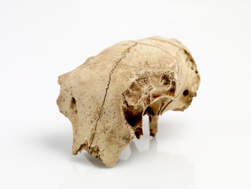
The model sits at the centre of the new medieval gallery, Origins, and this is deliberate. It’s not a stand-alone interactive, as it has been designed to act as a ‘gateway’ for understanding all of the medieval objects on display in the gallery. This brings me on to one of my favourite objects; the skull of a hunting dog. It’s most likely the skull of a greyhound, one of the oldest breeds of dog known to man. The skull dates from the 14th century and was actually found at Weoley Castle, around six miles from Birmingham city centre.
Skull of a hunting dog now on display in the new History Galleries, Birmingham: Its People, Its History.
So, how is it relevant to the model of medieval Birmingham? Well, the de Birmingham lords would have also kept greyhounds, and we know this from the extensive deer park that existed next door to the town.
William de Birmingham hunting in his deer park.
In fact, the deer park existed before the town. The manor of Birmingham covered an even larger area stretching from the River Rea in Digbeth at one end, to Edgbaston at the other. The town Peter de Birmingham founded in 1166 occupied a small patch of land within the manor in comparison, but as the town became more successful, the subsequent de Birmingham lords released more of their deer park, until eventually it was absorbed by the expanding town.
The water-filled ditch in the middle of the image acted as the boundary line of the town. By 1300, tanning pits were occupying what was once the deer park.
The greyhound skull can tell us a lot about how land usage gradually changed in medieval Birmingham. Any self-respecting lord of the manor had a deer park because venison was a luxury meat and being able to invite your friends over to hunt was a sure sign of status. For the de Birminghams to ‘sacrifice’ something that represented their social standing, the town had to be prospering, and it was. Initially it was probably ‘topping-up’ their annual income, but the realisation of the town’s success and potential convinced them to release more land from their manor. This allowed the town over time to get bigger and meet the growing demand of trade. The idea of lordship was changing and land usage was changing with it. The town was now becoming the status indicator rather than the deer park.
Greyhounds were bred for the nobility in the Middle Ages and any ‘commoner’ caught with one would be severely punished and the dog killed. This was seen as a justifiable act to preserve hunting rights.
My greys running on Bamburgh beach this year and probably why I’m obsessed with this object! The breed is still favoured for its speed and agility today.
We can use this object to understand how feudalism was breaking down in Birmingham and England as a whole. The park was becoming gradually less important as the town prospered. That’s to say that the deer park was now more valuable to the lord as part of the town, than it was as his hunting ground. The economy was no longer solely based on feudal obligations, whereby peasants worked the land for the lord in return for living on his manor. We know that in Birmingham as early as 1232, sixteen townsmen had come to an agreement with William de Birmingham (an earlier William than the one featured in our model) to free themselves from their haymaking duties. It was more beneficial to William for these merchants and tradesmen to sell their goods at market and support the growth of his town, than to help out with this communal obligation. This was part of the gradual move from a land-based economy to a money-based economy.
By this stage, the lord of the manor was looking outwards rather than inwards, beyond the boundaries of the manor, as it was trade from the wider area that would secure the success of his town and his status as lord. Owning a town within your manor was now part of the aspirations of the aristocracy, and while deer parks were by no means out of fashion, it seems that for the de Birminghams, at least, entrepreneurial vision had superseded hunting pursuits in the ranks of lordly endeavours.
A successful investment! The market triggered Birmingham’s growth and the town continued to expand gradually into the rest of the manor.
Remember that the new History Galleries, Birmingham, Its People, Its History opens next month on 12th October.
Keep up to date with the progress of the galleries by following me on Twitter @CinnamonLatte17.
Sarah Hayes, Freelance Curator
Exploring Medieval Birmingham: part II
The 1296 Borough Rental referred to in my previous blog is the earliest known ‘census’ carried out in Birmingham. Official censuses didn’t begin in this country until 1801, but recording information about people, land and property has preoccupied governments since time immemorial. We know, for instance, that William the Conqueror commissioned the great land survey, Domesday Book, in 1086 to assess how much his newly occupied country was worth. The Borough Rental was no different in that its main purpose was to keep a record of the rents owed to the lord of the manor. However, like Domesday, it doesn’t give an accurate indication of Birmingham’s population, as it mainly lists principle tenants, those people renting land directly from the lord. William de Birmingham, Lord of the Manor, was in essence a landlord and generated much of his income from renting his land to Birmingham townspeople.
How William de Birmingham made his money! Just some of the burgage plots he rented out to the townspeople.
Our model isn’t just about buildings and institutions in medieval Birmingham, it’s first and foremost about the real people who lived in the town. The Borough Rental doesn’t just record the names of townspeople though. In some cases, it lists their trades and locations. This, together with archaeological evidence from the Bull Ring excavations, has given us a unique opportunity to quite literally trace their footsteps, or at least the general area of Birmingham they called home. We want to allow visitors to learn more about the real townspeople and to ‘interact’ with them through our model.
They can do this through a series of push buttons, which link to eight characters positioned around this interactive. The button will trigger a light and illuminate a character in the model, and visitors can learn more about where that person lived or worked. The characters we’ve chosen represent the wide spectrum of wealth and trades in Birmingham, ranging from the lord of the manor, to everyday folk like tanners and potters.
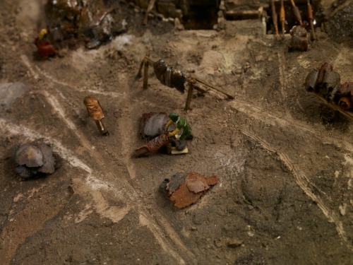
A tanner scraping skins to remove the unwanted hair.
Kilns were located in people’s back yards away from the main buildings because of the risk of fire.
Archaeology and history go hand-in-hand in this display as the two disciplines combined provide us with an invaluable insight into how people lived. For instance, there will be a selection of cattle horns on display which represent the established tanning industry in medieval Birmingham. The horns also serve to highlight the presence of Welsh cattle drovers who came here to sell their cows at market. With its abundant natural springs and streams scattered around the market place, Birmingham was the perfect place to water livestock. One of our characters, Richard le Couherde, which translates as the cow herder, would have played his part in helping the drovers to guide the cattle to market in the busy town. We know that Birmingham was already at the centre of a well-established road network by this stage, and there’s evidence to suggest that the roads the drovers used were already very old by 1300. Welsh names like Jones, Prys and Brangwayn even crop up in the Rental. While we don’t know if these men were drovers, we can safely assume that they, or their ancestors used these roads to make their journeys to Birmingham.
A cattle horn core found during the Bull Ring excavations in the late 1990s. Horn cores were the only waste product from the cattle, as everything else including the meat, skin and horn were sold.
Richard le Couherde driving the cattle to market or the ‘Bull Ring’ as it became known.
Birmingham was built on migration and this is a strong theme running throughout the new History Galleries. This trend was well under way in the Middle Ages, and was not simply a nineteenth and twentieth-century phenomenon as is often assumed. Other surnames in the Rental stress this point and include the likes of de Coventre (‘from Coventry’), Newporde (‘from Shropshire or Wales’), de Parys (very possibly ‘from Paris’) and those places closer to home, including de Edebaston (‘from Edgbaston’) and de Norton (‘from King’s Norton’).
Birmingham’s thriving market attracted migrants from nearby settlements. Its nearest competition came in 1300 when Sutton Coldfield was granted a market charter. By this point, Birmingham’s market was nearly 150 years old and too well-established for Sutton to pose a threat.
As well as locational surnames, the Rental lists many occupational names which were very common in the Middle Ages. Nicholas le Sawyer would have been responsible for many of the new builds in the town. Le Sawyer means the person who saws wood, and in a place constantly attracting new migrants, homes would have been in demand.
A sawyer hard at work.
Another new build, but this time workers are ‘raising the cruck’, which refers to the ‘A’ frame wooden beams they are hauling into place. The other common type of building was the ‘box frame’ to the left of the cruck.
One thing that tied all these people together were the rents they paid to William de Birmingham. But, even William wasn’t top of the tree. Above him were the Lords of Dudley from whom he held the manor of Birmingham, and above all of them was the king.
William de Birmingham in his deer park with his huntsman and greyhounds.
Having access to such a valuable document like the Borough Rental will help people to make more sense of the objects on display in the new History Galleries. While we don’t know the biography of people’s lives in the medieval town, we can make links through their professions, where they lived and even the names we share with them. We can identify with their daily struggle to pay the rent and put food on the table, and while we can never fully ‘know’ them, we can learn more than we ever could have hoped for, simply because of the discovery of this document just a few years ago. It just makes you wonder what else is out there, above ground and below!
Read Exploring Medieval Birmingham: part I.
Sarah Hayes, Freelance Curator
Follow me on Twitter @CinnamonLatte17 to keep up to date with the latest developments on the History Galleries.
Exploring Medieval Birmingham
A scale model allows visitors to depict a scene in a way that words or illustrations sometimes fail to do. To put it simply, it does all the hard work for the viewer by giving them a unique perspective that allows them to survey a landscape in its entirety. We wanted to do exactly that for our visitors. The model we recently commissioned for the new History Galleries illustrates what Birmingham might have looked like in 1300. ‘Might’ is deliberately used here because there are some physical features of the town for which we simply have no concrete evidence. For instance, we don’t know what the fabric of the buildings looked like and whether these buildings were front side or gable end onto the street. Timber framed buildings from the 13th century rarely survive. In Birmingham’s case, its oldest timber framed building is the 15th century Old Crown Pub in Deritend. Nevertheless, we’ve done what historians do best! We’ve used the abundant evidence we have relating to14th century buildings and the limited knowledge from the 13th to produce a ‘most likely’ case scenario.
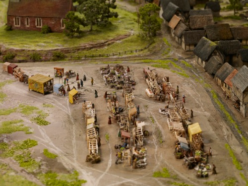
Model of medieval Birmingham in 1300. Notice the familiar triangular shape to the left of the model, which you can still see today as you walk downhill from New Street to St Martin’s Church.
Some people may be thinking ‘why not just focus on the later medieval period, for which we have more evidence?’ Well, we do have one tangible piece of factual evidence which we’ve based the blueprint of the model on. That is a document called a Borough Rental dating from 1296. This recently discovered document lists the names of townspeople who rented plots of land in Birmingham from the lord of the manor. It also tells us that there were 250 dwellings in Birmingham in 1296. Using this record, along with research from specialists, George Demidowicz and Mike Hodder, we have been able to map rented plots of land that existed in the town. These areas were known as ‘burgage plots’ and in some cases we can pinpoint exactly where certain townspeople lived.
The distinctive long and narrow burgage plots were a common feature of medieval towns. You can also see the ‘half’ plots, where land has been subdivided because of population growth or simply to generate more income.
One such person is Roger le Moul, the wealthiest merchant in 13th century Birmingham. Not only did he own 17 plots, he also gave his name to one of the best known streets in Brum: the Moulestrete of 1437 is today’s Moor Street. Birmingham, a place many assume emerged out of the Industrial Revolution was already thriving in the 13th century and this legacy is embedded in the surviving place and street names of the modern city! Our model, however, doesn’t show the full extent of medieval Birmingham. We’ve simply focused on the market place, the heart of the town, and the burgage plots that surrounded it.
A man who means business! Roger le Moul’s courtyard house, located on what later became Moor Street.
The Borough Rental also helpfully identifies the locations of Birmingham’s early industries, demonstrating why they were situated where they were. Tanning pits, a necessary component of the leather industry were located on Park and Edgbaston Streets. These streets were on the edge of the town and were ideal locations for such a noxious and smelly trade that used urine and animal faeces. Similarly, pottery making, another important early trade was located on the periphery of the town (on the site of Selfridges car park today) because of the fire hazards associated with the craft. In this way, the model really helps to emphasise the rationale of early town planning.
Tanning pits on Park Street, now the site of Selfridges.
Fire was one of the perils of everyday life in any medieval town.
The beauty of our model is that it will help to dispel the myth that there was nothing here in the Middle Ages, when in fact we know that Birmingham was a bustling market centre and home to around 1,500 people. So, if you want to meet William de Birmingham, Richard le Couherde or Isabell le Sonster amongst many other medieval Brummies, visit the new Birmingham History Galleries this October and immerse yourself in the medieval history that made our modern city.
Whether keeping animals, growing food, dying cloth or making pottery, people’s back yards really were places of activity in medieval Brum.
St Martin’s Church sat at the centre of the medieval market town.
The biggest house in town, and home to William de Birmingham, Lord of the Manor.
Look out for my next blog which focuses on the interactive features of the model.
Read Exploring Medieval Birmingham: part II.
Sarah Hayes, Freelance Curator.


